 www.geodatenkatalog.de (S1L)
Keyword
Geoscientific information
32632 record(s)
Provided by
Type of resources
Available actions
Topics
Keywords
Contact for the resource
Update frequencies
Service types
-
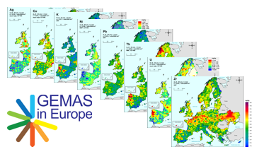
GEMAS (Geochemical Mapping of Agricultural and Grazing Land Soil in Europe) is a cooperative project between the Geochemistry Expert Group of EuroGeoSurveys and Eurometeaux. In total, more than 60 international organisations and institutions worldwide were involved in the implementation of the project. During 2008 and 2009, a total of 2219 samples of agricultural (arable land soils, 0 – 20 cm, Ap samples) and 2127 samples of grazing land (pasture land soils, 0 – 10 cm, Gr samples) soil were collected at a density of 1 site/2 500 km² each from 33 European countries, covering an area of 5,600,000 km². In addition to the chemical element contents, soil properties and soil parameters such as pH, particle size distribution, effective cation exchange capacity (CEC), MIR spectra and magnetic susceptibility were investigated in the samples and some coefficients were calculated. The downloadable files present the areal distribution of the determined RCR (risk characterisation ratio) for Molybdenum (Mo) in the shape of colour shaded contour maps.
-
GEMAS (Geochemical Mapping of Agricultural and Grazing Land Soil in Europe) is a cooperative project between the Geochemistry Expert Group of EuroGeoSurveys and Eurometeaux. In total, more than 60 international organisations and institutions worldwide were involved in the implementation of the project. During 2008 and 2009, a total of 2219 samples of agricultural (arable land soils, 0 – 20 cm, Ap samples) and 2127 samples of grazing land (pasture land soils, 0 – 10 cm, Gr samples) soil were collected at a density of 1 site/2 500 km² each from 33 European countries, covering an area of 5,600,000 km². All samples were analysed for 52 chemical elements after an aqua regia extraction, 41 by XRF (total), TC and TOC. In addition, the agricultural soil samples were analysed for 57 elements in a mobile metal ion (MMI®) extraction and Pb isotopes. All analytical results were subject to tight external quality control procedures. The GEMAS project thus provides for the first time fully harmonised data for element concentrations and bioavailability of the elements at the continental (European) scale. The downloadable files present the areal distribution of the element contents determined by different analytical methods in the shape of colour shaded contour maps with a classification in 7 and 72 levels each.
-
GEMAS (Geochemical Mapping of Agricultural and Grazing Land Soil in Europe) is a cooperative project between the Geochemistry Expert Group of EuroGeoSurveys and Eurometeaux. In total, more than 60 international organisations and institutions worldwide were involved in the implementation of the project. During 2008 and 2009, a total of 2219 samples of agricultural (arable land soils, 0 – 20 cm, Ap samples) and 2127 samples of grazing land (pasture land soils, 0 – 10 cm, Gr samples) soil were collected at a density of 1 site/2 500 km² each from 33 European countries, covering an area of 5,600,000 km². In addition to the chemical element contents, soil properties and soil parameters such as pH, particle size distribution, effective cation exchange capacity (CEC), MIR spectra and magnetic susceptibility were investigated in the samples and some coefficients were calculated. The downloadable files present the areal distribution of the determined Kd values (soil-solution partitioning values) for Nickel (Ni) in the shape of colour shaded contour maps.
-
GEMAS (Geochemical Mapping of Agricultural and Grazing Land Soil in Europe) is a cooperative project between the Geochemistry Expert Group of EuroGeoSurveys and Eurometeaux. In total, more than 60 international organisations and institutions worldwide were involved in the implementation of the project. During 2008 and 2009, a total of 2219 samples of agricultural (arable land soils, 0 – 20 cm, Ap samples) and 2127 samples of grazing land (pasture land soils, 0 – 10 cm, Gr samples) soil were collected at a density of 1 site/2 500 km² each from 33 European countries, covering an area of 5,600,000 km². All samples were analysed for 52 chemical elements after an aqua regia extraction, 41 by XRF (total), TC and TOC. In addition, the agricultural soil samples were analysed for 57 elements in a mobile metal ion (MMI®) extraction and Pb isotopes. All analytical results were subject to tight external quality control procedures. The GEMAS project thus provides for the first time fully harmonised data for element concentrations and bioavailability of the elements at the continental (European) scale. The downloadable files present the areal distribution of the element contents determined by different analytical methods in the shape of colour shaded contour maps with a classification in 7 and 72 levels each.
-
GEMAS (Geochemical Mapping of Agricultural and Grazing Land Soil in Europe) is a cooperative project between the Geochemistry Expert Group of EuroGeoSurveys and Eurometeaux. In total, more than 60 international organisations and institutions worldwide were involved in the implementation of the project. During 2008 and 2009, a total of 2219 samples of agricultural (arable land soils, 0 – 20 cm, Ap samples) and 2127 samples of grazing land (pasture land soils, 0 – 10 cm, Gr samples) soil were collected at a density of 1 site/2 500 km² each from 33 European countries, covering an area of 5,600,000 km². In addition to the chemical element contents, soil properties and soil parameters such as pH, particle size distribution, effective cation exchange capacity (CEC), MIR spectra and magnetic susceptibility were investigated in the samples and some coefficients were calculated. The downloadable files present the areal distribution of the determined Kd values (soil-solution partitioning values) for Molybdenum (Mo) in the shape of colour shaded contour maps.
-
GEMAS (Geochemical Mapping of Agricultural and Grazing Land Soil in Europe) is a cooperative project between the Geochemistry Expert Group of EuroGeoSurveys and Eurometeaux. In total, more than 60 international organisations and institutions worldwide were involved in the implementation of the project. During 2008 and 2009, a total of 2219 samples of agricultural (arable land soils, 0 – 20 cm, Ap samples) and 2127 samples of grazing land (pasture land soils, 0 – 10 cm, Gr samples) soil were collected at a density of 1 site/2 500 km² each from 33 European countries, covering an area of 5,600,000 km². All samples were analysed for 52 chemical elements after an aqua regia extraction, 41 by XRF (total), TC and TOC. In the agricultural soil samples, 57 elements in a mobile metal ion (MMI®) extraction and Pb isotopes ratios were also analysed. In addition to the chemical element contents, soil properties and soil parameters such as pH, particle size distribution, effective cation exchange capacity (CEC), MIR spectra and magnetic susceptibility were investigated and some coefficients were calculated. All analytical results were subject to tight external quality control procedures. The GEMAS project thus provides for the first time fully harmonised data for element concentrations and bioavailability of the elements at the continental (European) scale. The geochemical maps provided in the data series “GEMAS - Single element maps” and “GEMAS - Parameters and indices” show an unbiased representation of the distribution patterns of the investigated elements and parameters. The data series “GEMAS - Supporting information” provides additional information to support the interpretation of these geochemical maps. The data set “Annual mean temperature” belonging to this data series provides maps of the annual mean temperature in the project survey area in the years 1960-1990 and 1970-2000 (data sources: UCDAVIS, worldclim.org).
-
GEMAS (Geochemical Mapping of Agricultural and Grazing Land Soil in Europe) is a cooperative project between the Geochemistry Expert Group of EuroGeoSurveys and Eurometeaux. In total, more than 60 international organisations and institutions worldwide were involved in the implementation of the project. During 2008 and 2009, a total of 2219 samples of agricultural (arable land soils, 0 – 20 cm, Ap samples) and 2127 samples of grazing land (pasture land soils, 0 – 10 cm, Gr samples) soil were collected at a density of 1 site/2 500 km² each from 33 European countries, covering an area of 5,600,000 km². All samples were analysed for 52 chemical elements after an aqua regia extraction, 41 by XRF (total), TC and TOC. In addition, the agricultural soil samples were analysed for 57 elements in a mobile metal ion (MMI®) extraction and Pb isotopes. All analytical results were subject to tight external quality control procedures. The GEMAS project thus provides for the first time fully harmonised data for element concentrations and bioavailability of the elements at the continental (European) scale. The downloadable files present the areal distribution of the element contents determined by different analytical methods in the shape of colour shaded contour maps with a classification in 7 and 72 levels each.
-
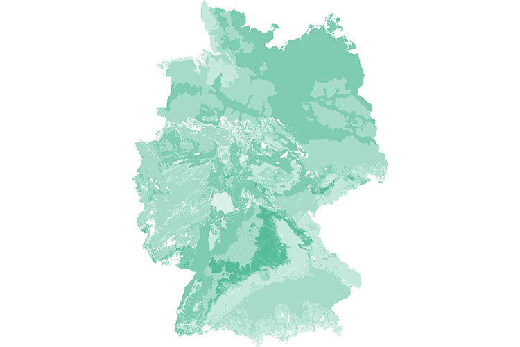
The spatial distribution of geogenic groundwater background values for hydrogeochemical and physicochemical parameters of the near-surface groundwater bodies is represented based on the HÜK200. Background values are used to describe the nature of the groundwater bodies and provide a basis for decisions on the differentiation between geogenic and conspicuous data. The representation of background values is a contribution of SGD and BGR to describe groundwater bodies and thus serves to implement the European Water Framework Directive (WFD).
-
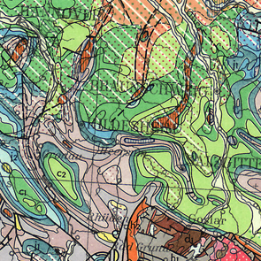
The International Geological Map of Europe and the Mediteranean Regions 1 : 1 500 000 ("Carte Géologique Internationale de l'Europe et des Régions Méditerranéennes 1 : 1 500 000") shows the geology of the European continent from the Ural mountains in the east up to Island in the west and the whole mediteranean region in the south. The geology is differenciated in stratigraphy, igneous and metamorphic rocks. In addition there are two legend sheets and a title sheet. The language of the series is French.
-
GEMAS (Geochemical Mapping of Agricultural and Grazing Land Soil in Europe) is a cooperative project between the Geochemistry Expert Group of EuroGeoSurveys and Eurometeaux. In total, more than 60 international organisations and institutions worldwide were involved in the implementation of the project. During 2008 and 2009, a total of 2219 samples of agricultural (arable land soils, 0 – 20 cm, Ap samples) and 2127 samples of grazing land (pasture land soils, 0 – 10 cm, Gr samples) soil were collected at a density of 1 site/2 500 km² each from 33 European countries, covering an area of 5,600,000 km². All samples were analysed for 52 chemical elements after an aqua regia extraction, 41 by XRF (total), TC and TOC. In addition, the agricultural soil samples were analysed for 57 elements in a mobile metal ion (MMI®) extraction and Pb isotopes. All analytical results were subject to tight external quality control procedures. The GEMAS project thus provides for the first time fully harmonised data for element concentrations and bioavailability of the elements at the continental (European) scale. The downloadable files present the areal distribution of the element contents determined by different analytical methods in the shape of colour shaded contour maps with a classification in 7 and 72 levels each.